Gilgit
-Baltistan
Where the Karakoram, Himalayas, and Hindu Kush collide.
Discover Pakistan\'s crown jewel. A land of ancient Silk Road cultures, towering 8,000-metre peaks, vast glaciers, and turquoise alpine lakes. This is the ultimate mountain frontier.
A Collision ofGiants
Gilgit-Baltistan (GB) is an autonomous territory in northern Pakistan, representing one of the most rugged, spectacular, and isolated mountainous regions on the globe. Spanning over 72,000 square kilometers, it is bordered by China to the north, Afghanistan\'s Wakhan Corridor to the northwest, and the Indian-administered territories of Jammu and Kashmir to the southeast.
What makes GB geographically unparalleled is that it is the profound nexus point where the world\'s three greatest mountain ranges meet: the Karakoram, the Himalayas, and the Hindu Kush. Explore our guide to the famous mountains and glaciers of the region.
This convergence creates a landscape of extreme superlatives. GB is home to 5 of the 14 independent Eight-thousanders (out of 14 globally), including K2 (8,611m) and Nanga Parbat (8,126m). Furthermore, outside the Earth\'s polar caps, GB holds the largest concentration of glaciated area, feeding rivers that sustain millions.
But Gilgit-Baltistan is more than rock and ice. Hidden within these deep gorges are vibrant, distinct cultures. For millennia, this region was a crucial artery of the ancient Silk Road. Today, the legendary Karakoram Highway (KKH) traces those historic footsteps, offering travelers what is widely considered the most spectacular road trip on Earth.
"When you leave Gilgit-Baltistan, a piece of your soul stays anchored to the Karakoram forever."
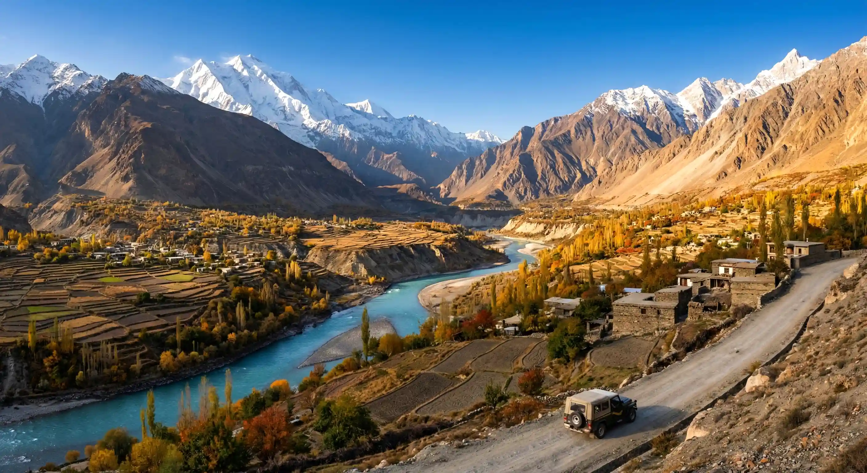
Skardu Valley
Summer colors in Skardu Valley
A Tapestry of History & Culture
Long before modern mountaineers arrived, Gilgit-Baltistan was a bustling, critical artery of the ancient Silk Road. For thousands of years, merchants, monks, and explorers traversed these treacherous valleys, exchanging goods from China, Central Asia, and the Indian subcontinent.
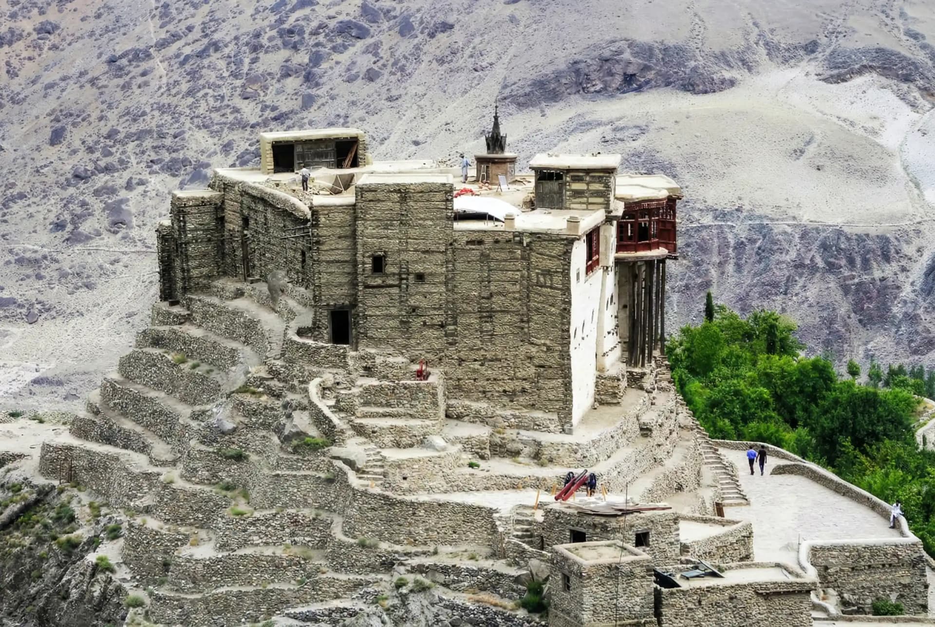
This historic crossroads resulted in an incredibly rich amalgamation of cultures. You will find ancient Tibetan Buddhist rock carvings scattered near Skardu and Gilgit, legacy fortifications like Baltit and Shigar Forts built by ruling Mirs and Rajas, and a profoundly hospitable, pluralistic Islamic culture.
The region is a linguistic goldmine, echoing with ancient tongues like Balti (closely related to classical Tibetan), Shina, Wakhi, and Burushaski—a language isolate with no known relation to any other language on Earth. From the legendary polo matches played at the roof of the world in Shandur, to the vibrant autumn harvest festivals of Hunza, the heritage of Gilgit-Baltistan is as towering as its peaks.
The ThreeGreat Ranges
Gilgit-Baltistan is the only place on Earth where three of the world\'s most formidable mountain systems physically converge.
The Karakoram
The most heavily glaciated part of the world outside the polar regions. It is home to four of the fourteen 8,000-metre peaks, including K2 (8,611m), Broad Peak, Gasherbrum I, and Gasherbrum II. Known for its vertical granite spires, massive glaciers like the Baltoro, and sheer, unforgiving brutality. It is the ultimate testing ground for high-altitude mountaineers.
The Himalayas
The western anchor of the Great Himalayas terminates in Gilgit-Baltistan at the colossal massif of Nanga Parbat (8,126m). Unlike the Karakoram's stark rock and ice, the lower Himalayan valleys like Astore and Fairy Meadows feature lush alpine pine forests, creating a dramatic contrast against the towering snow peaks.
The Hindu Kush
Stretching westward into Afghanistan, the Hindu Kush range in GB is characterized by deep, isolated valleys and stark, arid landscapes. It forms the natural border between GB and the Wakhan Corridor. The highest peak here is Tirich Mir, though in GB, the Hindu Raj subset dominates the Ghizer district with stunning alpine lakes and high passes.
Districts ofStaggering Beauty
From the high-altitude deserts of Skardu to the verdant terraces of Hunza, every valley possesses its own distinct heartbeat and culture.
Gilgit District
The administrative and logistical hub of the region. Gilgit town serves as a historic hub on the ancient Silk Road, connecting the Karakoram Highway to the rest of the north. Home to the ancient Kargah Buddha and the stunning Naltar Valley.
Skardu District
The capital of Baltistan and the gateway to the world's highest peaks. It features the surreal Katpana Cold Desert, the historic Kharpocho Fort, and serves as the primary access point for the vast Deosai National Park and Sadpara Lake.
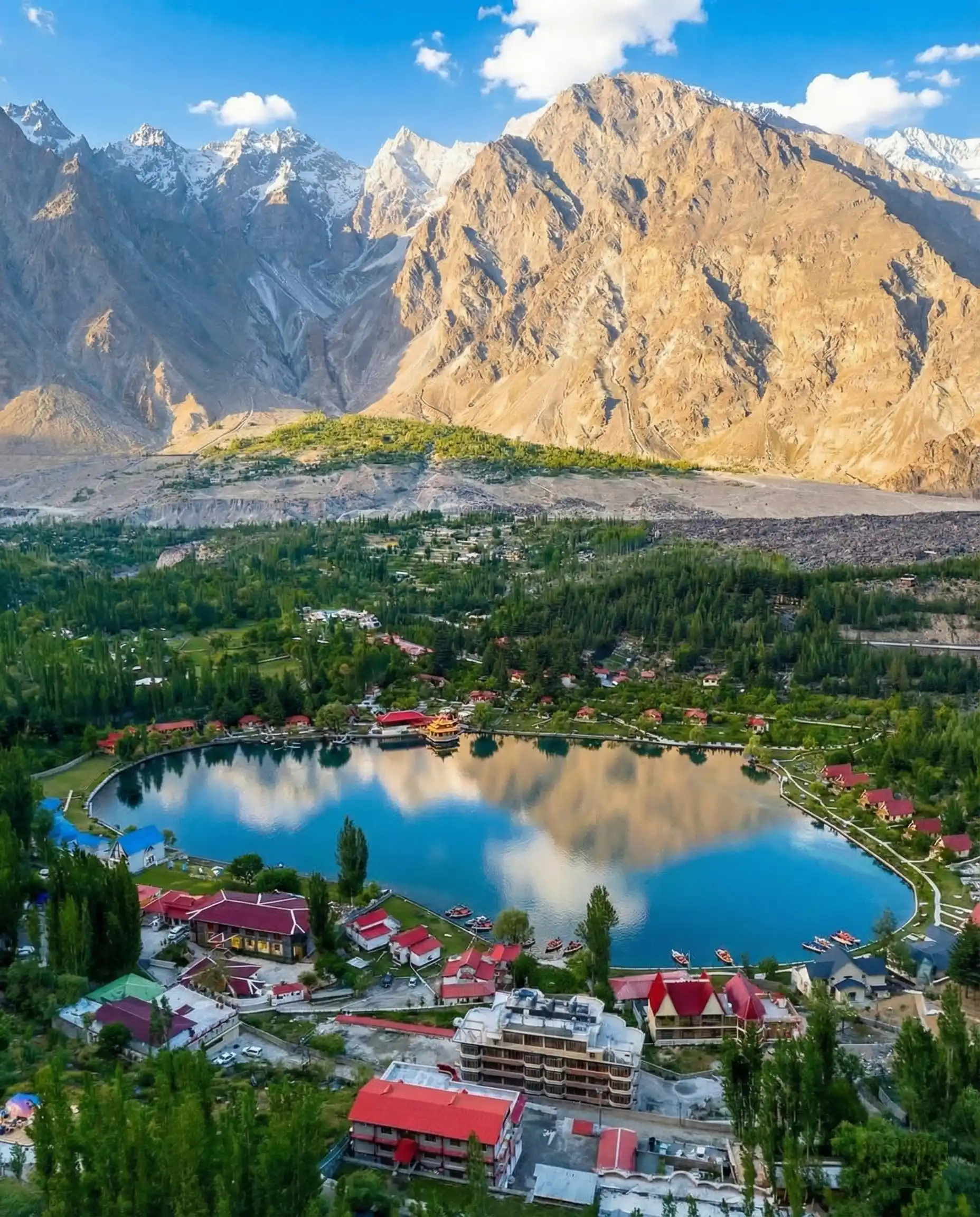
Hunza District
World-famous for its incredible longevity and hospitality. Hunza is home to the stunning 700-year-old Baltit Fort and Altit Fort. The turquoise Attabad Lake and the iconic Passu Cones are must-visit landmarks of this valley.
Nagar District
Hunza's direct neighbor, Nagar is home to the majestic Rakaposhi mountain and the immense Hopar Glacier. It offers some of the most dramatic mountain vistas in the region and is known for its rich mining heritage.
Shigar District
A lush valley that transitions into the rugged heart of the Karakoram. It hosts the 17th-century Shigar Fort, the Sarfaranga Cold Desert, and Askole—the last permanent settlement before the K2 Base Camp trek.
Ghizer District
Often called the "Lake District" of Pakistan, Ghizer is a peaceful paradise of turquoise waters and trout. It features the mesmerizing Phander Lake and Khalti Lake, and connects GB to Chitral via the Shandur Pass.
Ghanche District
The easternmost district of Baltistan, Ghanche is known for its spiritual atmosphere and the 19th-century Khaplu Palace. The Hushe Valley here provides the closest trekking access to Masherbrum (K1).
Astore District
Famous for its lush green meadows and dense alpine forests. Astore is home to the beautiful Rama Lake and Meadows, and provides access to the massive Rupal Face of Nanga Parbat from Tarishing village.
Diamer District
The southern entrance to the region, dominated by the Raikot Face of Nanga Parbat. It is home to the world-famous Fairy Meadows and the Babusar Pass, connecting GB to the Kaghan Valley.
Kharmang District
Situated along the Indus River towards the LOC, Kharmang is famous for its towering waterfalls, most notably the Manthokha and Khamush waterfalls, and its unique, multi-stepped terraced fields.
Legendary
High Passes
Crossing the mountain barriers in GB involves traversing some of the highest, most breath-taking mountain passes driven or walked by humans.
Khunjerab Pass
4,693 mThe highest paved international border crossing in the world, connecting Pakistan to China.
Babusar Pass
4,173 mThe stunning summer gateway connecting the Kaghan Valley (KPK) to Gilgit-Baltistan.
Gondogoro La
5,585 mA formidable and technical trekking pass connecting the Baltoro Glacier with the Hushe Valley.
Shandur Pass
3,700 mThe "Roof of the World," home to the world's highest polo ground, connecting GB to Chitral.
Frequently AskedQuestions
Essential knowledge before traveling to Gilgit-Baltistan.
Is Gilgit-Baltistan safe for tourists?+
When is the best time to visit Gilgit-Baltistan?+
Do I need a special permit to visit Gilgit-Baltistan?+
How do I travel to Gilgit-Baltistan?+
What is the altitude of Gilgit-Baltistan, and is altitude sickness a risk?+
What languages are spoken in Gilgit-Baltistan?+
Can I use an ATM or credit cards in Gilgit-Baltistan?+
Your Journey Awaits
Experience theMagic of GB
Whether you are aiming to conquer K2 or seeking a culturally immersive Jeep safari through the Hunza Valley, our local experts are ready to guide you.