
Gilgit-Baltistan · Pakistan · Karakoram
Mountains, Rock Towers
& Glaciers of Gilgit-Baltistan
Five 8,000m giants. Nine soaring 7,000m peaks. World-record granite walls. Rivers of ice stretching 76km. No other region on Earth concentrates so much vertical wonder in one place.
Category 01
8,000m Mountains
Gilgit-Baltistan hosts five of the world's fourteen 8,000-metre peaks — more than any other province or region on Earth. Every one of these colossal summits is a serious expedition objective requiring months of planning, elite fitness, and years of high-altitude experience.
K2
The Savage Mountain
The most dangerous mountain on Earth. K2's near-perfect pyramid of rock and ice has repelled all but the most elite climbers — with roughly one death for every four summiters. No mountain on Earth commands more respect. It was the last of the world's 8,000m peaks to receive a second ascent and remains unclimbed in winter without controversy.
Nanga Parbat
Killer Mountain
The western anchor of the Himalayas and the world's ninth-highest peak. Nanga Parbat's Rupal Face — a 4,600m wall of rock and ice — is the largest mountain face on Earth. Hermann Buhl's solo first ascent in 1953, without oxygen, is considered one of the greatest feats in mountaineering history. The mountain claimed 31 lives before the first successful ascent.
Gasherbrum I
Hidden Peak
Named "Hidden Peak" because it is completely invisible from any inhabited settlement — accessible only via the Baltoro Glacier. Gasherbrum I is the most distant and isolated of the five 8,000m peaks in Gilgit-Baltistan. Its name comes from the Balti "Rgasha Brum" meaning "beautiful / shining wall." The normal route ascends the northwest face via a complex glacier approach.
Broad Peak
Falchan Kangri — The Wide Giant
Broad Peak's 1957 first ascent — by four Austrians in alpine style without oxygen or high-altitude porters — revolutionised 8,000m mountaineering. The summit ridge stretches nearly 2km above 7,800m, exhausting climbers at extreme altitude. The mountain is a popular pre-K2 acclimatization objective and its base camp offers perhaps the finest view of K2 anywhere on Earth.
Gasherbrum II
The Accessible Giant
With the lowest fatality rate of any 8,000m peak and over 1,200 successful ascents, Gasherbrum II is often recommended as a first 8,000m summit. Its relatively straightforward normal route via the SW ridge makes it accessible for well-acclimatised climbers. It shares a base camp with Gasherbrum I, offering an efficient combination expedition.
Category 02
7,000m Mountains
Beyond the eight-thousanders, Gilgit-Baltistan is home to dozens of formidable 7,000m peaks ranging from accessible trekking objectives to near-unclimbed technical pinnacles. Many of these peaks offer first-class mountaineering with far less crowding than the famous 8,000m giants.
Disteghil Sar
7,885 mThe highest peak in the Hispar Muztagh sub-range with very difficult mixed terrain. First climbed by an Austrian team in 1960, the mountain is rarely attempted due to complex approach and extreme difficulty.
Masherbrum
7,821 mOne of the most visually striking peaks in the Karakoram — a towering near-perfect pyramid dominating the view from the Hushe Valley. Its K1 designation precedes K2 in the original survey numbering.
Rakaposhi
7,788 mRises ~6,000m from the Hunza River — one of Earth's greatest vertical reliefs from valley to summit. Visible from the Karakoram Highway, Rakaposhi is often the first great mountain travellers encounter en route to Gilgit.
Batura Sar
7,795 mThe highest peak of the Batura Muztagh sub-range. Its glacier — the Batura Glacier — is one of the longest outside polar regions. The mountain dominates the upper Hunza Valley above Passu village and poses serious technical challenges on all sides.
Malubiting
7,458 mA massive glaciated pyramid in the Haramosh Mountains near the Indus River. First climbed by a German-Austrian team. The peak offers three major faces of technical climbing and remains rarely attempted by modern expeditions.
Momhil Sar
7,414 mLocated in the Hispar Muztagh, Momhil Sar's isolated position and difficult approach have kept it a rarely-visited objective. It offers exceptional views of the Hispar Glacier system and surrounding 7,000m peaks.
Ultar Sar
7,388 mTowers directly above Karimabad — with a vertiginous 5,000m rise from the valley floor. One of the most difficult 7,000m peaks ever climbed; its sheer faces and avalanche-prone slopes repelled more than two decades of attempts before the first ascent.
Spantik (Golden Peak)
7,027 mKnown as "Golden Peak" for the stunning golden glow its snow-covered summit radiates at sunrise and sunset. A popular objective for high-altitude trekkers and climbers, accessible from the Arandu Valley. First climbed by a Polish-British team in 1987.
Diran
7,266 mOne of the more frequently climbed 7,000m peaks thanks to its relatively accessible approach from Minapin village. Despite this, avalanche-prone slopes have claimed many lives. Offers superb views of Rakaposhi and the Nagar Valley.
Category 03
Famous Rock Towers & Spires
The Karakoram contains the most spectacular collection of vertical granite on Earth. These towers have inspired generations of elite rock climbers from around the world.
Great Trango Tower
6,286 mContains the greatest near-vertical drop in the world — 1,340 metres of sheer granite on the east face. The Trango group draws the world's elite big-wall climbers for multi-day ascents requiring advanced aid climbing, free climbing, and Alpine-style competence.
Nameless Tower (Trango Tower)
6,239 mCalled "the most beautiful big wall in the world." Its perfectly vertical 1,200m east face is one of the ultimate objectives in big-wall climbing. First climbed by a four-person British team. The Slovenian and Norwegian routes have pushed the technical limit of rock at altitude.
Shipton Spire
5,852 mNamed after legendary explorer Eric Shipton. A slender, needle-like granite spire with near-vertical routes on all faces. Often described as one of the most aesthetically perfect rock towers on Earth. The Ship of Fools route (2001) is considered one of the hardest alpine-style routes in the Karakoram.
Uli Biaho Tower
6,109 mA dramatic, isolated granite spire rising south of the Trango group. First climbed in 1979 by American climbers. The tower's remote position and sustained technical difficulties make it one of the least-repeated major first ascents in the Karakoram — only a handful of ascents have been completed.
Cathedral Spires
Various (5,400–5,800 m)A collection of dramatic granite pillars resembling a gothic cathedral's flying buttresses and spires. Visible from the Baltoro Glacier approach, they are a signature landmark on the trek to Concordia. Multiple routes up various pillars offer challenging granite climbing in an unforgettable setting.
Latok Towers
Latok I: 7,145 mThe Latok group contains some of the most coveted unclimbed objectives in mountaineering. Latok I's stunning north ridge was attempted 30+ times before a partial ascent in 2018. The 2,000m north face is considered the "last great problem" of the Karakoram and has defeated every major expedition that has attempted it.
Category 04
Major Glaciers
The Karakoram contains the greatest concentration of glacial ice outside the polar regions. These slow-moving rivers of ice carve the valleys, supply water to millions, and serve as the access routes to the world's highest peaks.
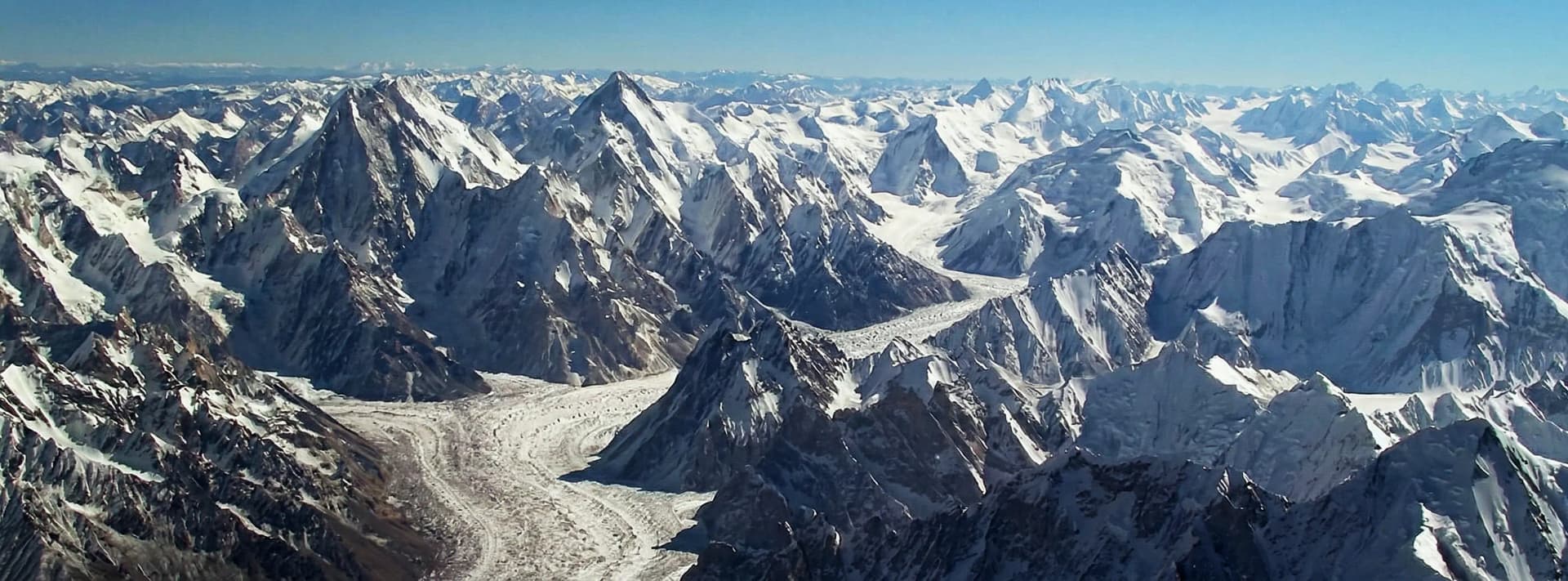
Baltoro Glacier
The most famous glacier in the world. A frozen highway leading through the heart of the Karakoram to Concordia — where four 8,000m peaks surround a single campsite. The Baltoro is one of the longest non-polar glaciers and forms the approach route for expeditions to five 8,000m peaks.
K2, Broad Peak, GI, GII, Concordia
Biafo Glacier
Connects with the Hispar Glacier via Snow Lake to form a 100km+ continuous ice traverse — one of the great trekking challenges on Earth. Snow Lake itself is a vast glacial basin at 4,800m ringed by 6,000m peaks, one of the most remote and spectacular landscapes in Asia.
Snow Lake (Lukpe Lawo), Hispar Pass
Hispar Glacier
Part of the legendary Biafo–Hispar traverse. The glacier flows from the remote Hispar Pass (5,128m) down through the glacial wilderness of the Hispar Muztagh. The combined Biafo–Hispar system is longer than any non-polar glacier in the world outside of Patagonia.
Hispar Pass, Disteghil Sar base
Siachen Glacier
The world's largest non-polar glacier and second longest after the Fedchenko in Tajikistan. Located in the eastern Karakoram on the Pakistan–India border. A contested military zone since 1984, the Siachen remains the world's highest battlefield. The glacier feeds the Nubra River system in Ladakh.
Sia La, Bilafond La passes
Batura Glacier
One of the few major glaciers in the world accessible directly from a major highway. The Batura Glacier flows beneath the massive Batura Sar (7,795m) and the iconic Passu Cones. The glacier snout can be easily visited on a half-day walk from the Karakoram Highway near Passu village.
Batura Sar base, Passu Cones views
Passu Glacier
Arguably the most accessible major glacier in all of Gilgit-Baltistan — its snout sits just minutes from the Karakoram Highway. Famous for spectacular "cathedral" ice seracs and the towering backdrop of the Passu Cones (7,478m). A short walk from Passu village leads directly onto the glacier.
Passu Cones, Batura views
Hopper Glacier
Gateway to Rush Lake — one of the highest alpine lakes accessible to trekkers, sitting at 4,694m with panoramic views of Diran, Golden Peak, and dozens of surrounding summits. The 3–4 day trek from Hopper village crosses the glacier moraines through spectacular high mountain terrain.
Rush Lake (4,694 m), Rush Peak
Chogo Lungma Glacier
One of the lesser-known but spectacular glaciers in Gilgit-Baltistan, draining the southern slopes of the Haramosh and Rakaposhi ranges. The glacier approach passes through remote valleys with virtually no other trekking traffic, offering a true wilderness experience away from commercial routes.
Malubiting, Haramosh base
Must-Know Location
Concordia — The Throne Room
of the Mountain Gods
At 4,690m, where the Baltoro and Godwin-Austen Glaciers meet, Concordia offers what many consider the greatest mountain panorama on Earth. From camp, you simultaneously see K2, Broad Peak, Gasherbrum I, II & IV, Khisar Peak, and Mitre Peak. The 7–9 day trek from Askole is one of the truly transformative journeys of a lifetime.
Plan Concordia TrekBegin Your Journey
Ready to ExperienceGilgit-Baltistan?
Our Askole-based team runs treks to Concordia, K2 Base Camp, Broad Peak, the Trango Towers region, and expeditions across Gilgit-Baltistan — with the local knowledge no operator from outside the region can match.